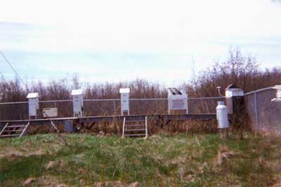
Brule River, WI is located on the western end of Lake Superior, approximately 270 km southwest of Thunder Bay, Ontario and about 35 km west of the Duluth-Superior urban/industrial area, which has over 100,000 residents. The sampling site is about 300 meters from Lake Superior, next to the mouth of the Brule River, about 20 km north of Brule, WI. The site is served by an unpaved gravel county road about 100 meters west of the site. Within 300 meters is a state of Wisconsin parking lot at the mouth of the river. Tourist traffic can be heavy during warmer months.
The site itself is located in a grassy meadow, adjacent to mixed forest. There are a few residences within one km to the southwest of the site. Land use is mainly forestry with some agriculture along roads and highways.
- Location
- 46.74750, -91.60833
- Elevation
- 192 meters
- Operating Years
- 1994 — 2002
- Equipment
- One MIC Precipitation Samplers
- One High Volume Sampler for Organics (Vapor and particle phase)
- One Meteorological Tower


